Tuesday, December 5, 2017

The Bradt-Oliver House

For the October 2017 issue of Our Towne Bethlehem I wrote about our area's old stone houses, especially those of the Onesquethaw Valley Historic District.   Illustrating the story, and gracing the cover, was this image of the Oliver-Bratt house on Van Dyke Road.


My caption for the photo simply said "The Bratt – Oliver House on Van Dyke Road has undergone many architectural changes over the years.  It is now part of the Spinney community and was once part of the Leonard Farm."

I am pleased to report that a member of the Leonard family, Brian Leonard of North Carolina, reached out to Our Towne with more photos and remembrances of growing up in this home on Van Dyke Road.   I like Brian's way with words, and with his permission, here's his whole letter.  Enjoy!
Circa 1940

Dear John and Marjorie,

      A couple of weeks before today, Thanksgiving 2017, I was visiting with my dad, Richard Leonard, and he shared a copy of the October 2017 issue of Our Towne that my aunt Barbara had sent to him. What a pleasant surprise to see my childhood, ancestral, home on the front cover.
     As is usual for a couple of old men, that led us down a path of reminiscing about the [Leonard] farm. Not that it makes me any more special than anyone else in this world, but the thought of that farm, and how my family’s history was so closely tied to it, always makes me feel like the I am the luckiest man in the world.
     Lucky me, I’m the last in line. Quite literally, arguably, the last of my family to be born and raised at 246 Van Dyke Rd.  While the farm only carried the name Leonard for a brief time, beginning around 1920 when my great grandfather Ralph Irving Leonard bought the farm from his sister in law and ending with the sale to the owner’s of Spinney Preserve, it has been part of my larger family’s heritage since the Van Rensselaers were the prominent landholders in the area.
     The house, now called the Bradt-Oliver house, (both names show up in the Leonard genealogy) was an absolutely idyllic place for a boy to grow up, and even though I didn’t understand its personal historic significance, I relished the fact that the house I was raised in wasn’t your typical modern home. Add a little over one hundred acres to the scene and it becomes obvious why that place is special.
Circa 1940

     The old stone part of the house, the original house, caught my great grandfather’s eye and he spent a long time turning it into his dream home with his wife, Lillian Salisbury. Prior to buying the farm he had been a carpenter for the NY Central RR and used those skills, and timber harvested from the farm, to more than double the living space during the 1950’s and early 1960’s. I have heard a few rumors over the years that there are stories of an even older cabin having been on, or near, the house site but no one that I’m aware of has presented any real evidence.
     The original part of the house was, as you noted, built some time before 1768, and was a fairly typical pre-colonial Dutch influenced home. A simple rectangle with stone walls almost 2 feet thick chinked with a combination of mud and horse hair. It was built as a single living level split into two rooms, with a haymow above and a cold cellar below.  The floors are all hand hewn tongue and groove with beams that measure better than a foot across. One of my favorite things about “the front room” (our term for the old house) were the twelve over twelve windows. I’ve visited the house a few times over the years since moving away and am sad to see those windows have been replaced. To my own discredit, however, I personally may have had a little to do with that, having broken and repaired several panes during childhood activities.

     I don’t recall the details but I do recall seeing names and dates here and there on the old woodwork. Though I’ll add the most notable date to me, 1807, was carefully carved in a beam of “the big barn” that once stood on the other side of Van Dyke Rd.
     I don’t think I’m alone in feeling that, as youngsters, we all tend to be too busy growing up to notice, or care about, these things. But as I’ve aged I’ve come to see that is something almost all of us look for. Our place. Where we are, where we’re going, where we came from, who our people are.  And that is one of a myriad of reasons why I feel so lucky. Last in line or not, I was given a rare chance to grow up steeped, literally, in my peoples history.
     I could go on and on, boring you with stories of life at that end of Van Dyke Rd. Such as how songbirds nesting in the stone walls surrounding my bedroom would wake me, literally, every day an hour before sunrise, or snowshoeing the snow covered fields on a pair of bear paws that “are older than I am” according to my dad. Plus other rites of passage, like the sunny summer morning of my seventh year when my grandfather, Irving Ralph, stuck me on the Ford 8n his father bought new in 1947 and taught me to drive. And for you romantics things like first kisses in the barn’s haymows.           But I digress.
     I will close with this thought. I believe we honor our ancestors, near and far, by remembering them. Thank you for taking your time and remembering some of mine.

Brian Leonard
Circa 1988

Monday, November 27, 2017

A Slingerlands Postcard

(Seeing as how I haven't posted in a while - here's two in one day!)

Poking around in the two dollar postcard box in an antique store in Cohoes (shout out Dennis Holzman) this weekend I came across a few wonderful finds for my own collection.  The Indian Ladder at Thatcher Park, Albany at Night, and these Bethlehem beauties.


The top and bottom ones are familiar, I think they've both made an appearance on this blog, but it is fun to have my own copies.  The one in the middle is a new one to me.


I immediately wondered about the West Main Street part.  I have never heard or seen New Scotland or Kenwood referred to as Main Street, never mind West Main Street.  Maybe it is a stock photo, but maybe it is our Slingerlands.  When blown up in a larger view, the houses visible in the trees on the left could be ours. So I am calling this one plausible. 

What I really enjoyed was the message on the back and Mother Birdswell's comment about her "nice auto ride last night, the longest one I ever had."  The card is postmarked July 19, 1915.


Bethlehem Downs

I've been hanging out at the Delmar Farmer's Market the last couple of Saturdays with the good folks of the Bethlehem Historical Association.  I enjoy talking about our history and  listening to people reminisce about growing up here.  I'm often asked if I know anything about specific houses and wish I had old photos of each and every one. Sometimes, people like to play stump the historian, which I must confess is often too easy to do.

One gentleman handed me this card and asked me if I had ever heard of the racetrack off of 9W near the Raven/Coeymans line.  I've written about horse racing in Bethlehem before, but had never heard of the Bethlehem Downs. 


So of course, this afternoon I had to do a little newspaper sleuthing. 

Turns out in 1972, Charles Russo and his son Peter proposed the Bethlehem Downs quarter horse track.  They said it would be the "plushest" in the racing industry. They held a ground breaking in June of 1973 and one newspaper reported plans for a $200,000 purse.  Unfortunately, the Russo's plans don't seem to have come to fruition. The Ravena News-Herald, in February 1974, reported that Dawn Branstrom was enjoying her new quarter horse, a Christmas gift from her parents.  They go on to say, "We don't know if she is getting ready for Bethlehem Downs when and if it opens, but we do know she is going to be one of Selkirk's most ardent horsewomen."  The latest newspaper article I found is from March 1976 when the Jigger Sports columnist (in the Leader-herald of Gloversville) reported on the Down's financial struggle and complications of getting the track off the ground.

Seeing as how this is an article about quarter horse racing, hop on over to the American Quarter Horse Association website for some info on quarter horse racing.  As they say, "Quarter Horses are traditionally short, stocky horses that are specialized sprinters.  They are the dragsters of the horse racing world."  Pretty different from the long legged darlings of Saratoga!

https://www.aqha.com/daily/riding/2016/riding-archive/american-quarter-horse-racing-basics/


PS Thank you Bill S. for this fun round of Stump the Historian!

Thursday, October 12, 2017

Delaware Avenue photos at the library this month!

Stop by the Bethlehem Public Library now through October 31 and you can see my exhibit Delaware Avenue: A Look Back. It has some great old photos of the Delaware Avenue corridor.

Since I don't always have my act together,  I haven't taken a snap shot of the actual show yet.  So here are a couple of views of a Delaware Avenue building that just came my way yesterday.  They aren't in the show, but might inspire you to stop by!

Love the Great Atlantic and Pacific Tea Company sign.  That would be more commonly known as the A&P. 

A close up of the corner entrance for Woods 5 and Dime.

P.S. This building was at the corner of Delaware and Kenwood where Key Bank is today.

P.S.S. Did you spot the random dog who just happened to be walking by?


Tuesday, September 26, 2017

LJ Mullens Pharmacy and Dempf's Bakery

I can't believe it has been over a month since I posted here! Rest assured I am still thinking history thoughts!  In the mean time here are a couple of old photos that have come my way recently.


Enjoy!


Wilbur Rhenow standing at the door of the L.J. Mullen Pharmacy.  He grew up in Delmar, graduating from BCHS in 1936.  He married fellow BCHS grad Elizabeth Wordon.  The 1940 census says Wilbur worked at the pharmacy 57 hours a week and was paid $780 per year.  The building still stands on Delaware Avenue at the corner of Groesbeck Place/Elsmere Avenue. 


Louis Dempf operated his bakery (center)  on Delaware Avenue from 1927 to 1954.  The center, brick building and house on right are long gone, the one on the left still stands near the underpass. 


Here it is in the process of coming down in 1995.


Wednesday, July 26, 2017

An Adams Street Deed

A friend of mine let me borrow the abstract of title/deed to her property on Adams Street.  It traces her small suburban plot back to two large tracts of land leased by the patroon.  One is 162 acres leased by Stephen Van Rensselaer to Garrit Walley on March 8, 1793.  The other lease is dated May 9th, 1803 and is between Van Rensselaer and James McKie.

The McKie lease was assigned to Nathaniel Adams (a familiar Delmar name) in 1854. "thus Nathaniel Adams became seized of the parts of said land lying South of Delaware Turnpike and West of New Scotland Road, and as he acquired also the leasehold title, the leases were extinguished, and he became the owner in fee of said premises."

Are you with me so far? The deed describes the tracts with links, chains and a pitch pine tree. It cites the annual rent for both properties in bushels of wheat, fat foul and a day's service with carriage and horses.  All pretty straight forward stuff.

This is the Walley lease, only 16 bushels of wheat.  The larger McKie tract requires "27 bushels of wheat and one-half bushel of clean merchantable winter wheat." Both required four fat fowl and a day's service.

But did you notice the really intriguing bit? McKie's lands are west of New Scotland Road. Moreover, the first line of the abstract (this section was completed in 1912 by E.W. & E.B. Rieck, Attorneys at Law.) states "I am informed that the distance from the center of the New Scotland Road to the West side of Adams Street on the South line of Delaware Turnpike, Delmar, N.Y. is 584 feet."

And then there is this map.


What isn't New Scotland Road in Slingerlands?!

Apparently, back in the day, what we know as Kenwood Avenue, was New Scotland Road. I did not know this - a new history fact!

I think the Riecks were confused as well.  Otherwise why start with that info about the distance to New Scotland Road?  On Google maps, you can measure the 584 feet and it puts you pretty squarely on Kenwood Avenue.  Very cool!  Sadly, the old maps do not have a lot of street names.  I did look in the Family directory of Delmar, published in June 1913, and there is no New Scotland Road in Delmar, just Kenwood Avenue so I don't know when the switch over took place.

Another fun aspect of this document is the restrictions placed on the lot when it was subdivided out by the heirs of Nathaniel Adams in 1912.

"Subject to restrictions that the parties of the second part will not sell or permit to be sold upon the premises and spirituous liquors, wine, beer, ale, porter, cider or any other intoxicating drinks, nor use the premises for any other purpose than for a residence or dwelling, and to erect a house to cost not less than $2000 and to set same at lease 32 ft. from Adams St. and to set outbuildings not nearer than 50ft. from Adams Street. "

What a fascinating glimpse into Bethlehem history!

Friday, July 21, 2017

Along the Delaware Turnpike

My next article for Our Towne Bethlehem is about the old Albany and Delaware Turnpike.  (You might be sitting in traffic there a lot this summer.) I came across this little article, and it made me smile.  Watch out! Mr. Scrafford's horses were on the loose in Normasnville in 1897.


 I think "a new Osborne Marker" is some sort of road sign, maybe a mile marker.  Google, however, is stumped.

The article is from the June 11, 1897 Altamont Enterprise.

Tuesday, June 27, 2017

More about those pesky Guy Park lions

Three years ago I wrote about those pesky Guy Park lions.  Go read it now.
http://bethlehemnyhistory.blogspot.com/2014/01/the-lions-at-cedar-hill.html


If you've ever been down to Henry Hudson Park you know the lions I am referring to.  And you  know that in recent years the ones that used to be on River Road have been moved and there are now two pairs along Barent Winne Road.  Both sets of lions are inscribed with the name Guy Park.

This morning I've been reading some old deeds I found in a folder related to the nearby Barent Winne house and dock.  Included was a transcript of the will of John Taylor Cooper.  The will is dated December 27, 1866, and specifically refers to the "farm and country seat town of Bethlehem known as Guy Park" (which by the way he bequeathed to his wife Angelica.)

My earlier blog entry cites a newspaper from 1969 which says

 “J. B. Lyon bought the estate in 1887 from the well-known James Fenimore Cooper.  Mr. Lyon called it Guy Park after the area in England from which he came."


So, apparently, both Cooper and Lyons called the property (and I do know it is the same property) Guy Park.  But why? Why?  Is it after a place in England? 

The only Guy Park I could find in England is Guy Street Park in London which is nearby to Guy's Hospital which was founded by Thomas Guy (1644-1724) who, wonderfully, was a printer and bookseller, just like J.B. Lyon.   

And, finally, to muddy the waters even more, a clipping from the Times Union from September 1897 about a party at "The Lions" which even includes a picture of the house.


Tuesday, June 13, 2017

Bethlehem Central School District History Research Project

My friend Beth Anderson is researching the history of the Bethlehem Central School District and would really like your input!  Pop on over to this Spotlight article for complete details.
http://www.spotlightnews.com/towns/bethlehem/2017/06/07/bcsd-grad-and-former-teacher-asks-community-for-help-documenting-the-districts-lesser-known-history/


     Beth Anderson, a Bethlehem graduate who taught English at the high school for 25 years, has recently undertaken a project to document the history of Bethlehem Central School District from those earliest years — and she’s asking the community for help filling in the considerable gaps.
     Anderson is hoping to connect with individuals who may have family members who remember the district’s earliest years or those who have memorabilia from older family members that were educated in Bethlehem. “I love digging and researching and finding,” she said. “And people need to understand what’s behind what they have.
     “Don’t let the history be lost,” urged Anderson. “We need to know what the foundation is and what we came from. I’d love any information, stories, old photos, any little ephemera or old programs. Any little thing that represents how it was in the early days of the district.”

Anyone with anything to share can reach Anderson at:
eeanderson58@gmail.com or (518) 439-3185.

Tuesday, June 6, 2017

A New View of a Bethlehem Gas Station - Updated!

A new-to-me picture turned up on my desk this morning.  While I've never seen this view before, I know exactly where this picture was taken.  Care to take a guess?


Ok folks, here is the site today.  And there is still a Mobil gas station there.  You can just make out the Pegasus in the old picture above.


It is Comstock's station at the corner of Feura Bush Road and 9W.

Saturday, May 6, 2017

25 Years Ago - Circa 1992

As you know, one of the fun parts of my job is the random things that turn up on the historian's desk. Last week, the town's planning department must have been cleaning house because I received a draft copy of a historic structures inventory completed in 1992 for the L.U.M.A.C. (i.e. the Land Use Management Advisory Committee.) Flipping through the pages, what struck me are the places that are gone and the places that were falling down then but all fixed up now.  What a difference 25 years can make.

Here are some favorites.

  Here's the Ironweed House (AKA the Dillenbeck House) on New Scotland Road in Slingerlands. Top is 1992, bottom is 2008.


 I always think of this one as the Moon House because of the moon shape cutouts in the shutters.  It is on the corner of Elsmere and Feura Bush Roads.  Top is 1992, bottom is 2008.


This is the Gerrit Oliver House which dates to the late 1700s.  It is at the end of Meads Lane near Delaware Avenue and is slowly returning to the earth. The top picture is 1992. The middle is 2009 and the bottom one is from Google Street View. I'm not sure of the date, but probably from 3 or 4 years ago.  (I only know this because I live not too far from here and the Street View of my house shows my old blue car.)


Now this one I was surprised to see still standing in 1992.  This big old place with its Second Empire style - love that massive mansard roof - used to be off of Krumkill Road across from where Schoolhouse Road comes in (the stub of road on the roundabout would have lead to this house.) According to LUMAC, is was built by J. I. Jacobson in the early 1850s.  His daughter (name unknown 😆) married J. L. Blessing and they remodeled and enlarged into the Second Empire style. Below are some pictures of the house from the late 1970s.  The place must have come down not too long after the 1992 picture.


And finally, this farmhouse, gone but not forgotten.  It was the Kelderhouse home, later part of Heath's Dairy.  It was located at the corner of 9W and Wemple Road.  Above is 1992, below is from Bing Maps and the house is just barely visible in the trees to the left of the barn.  Bottom is the same view from Google, and the house is gone.  Go enjoy those old barns while you can - they are sure to go soon.


Friday, April 14, 2017

Captured Moments at the Albany Institute

So last weekend I attended the Albany Institute's Beer & the Erie Canal fundraiser and wandered into their exhibition Captured Moments: 170 Years of Photography from the Albany Institute.  What a wonderful show with many, many interesting local history photographs.  Below are a couple of my favorites, because they are from Bethlehem of course.  My apologies for the poor quality - this fundraiser involved beer after all - and I snapped these with my phone.  Get on down to the exhibit before it closes on May 21!!!


Notice the Hudson River in the background of this photo?  It was likely taken at the Learned family property in Selkirk.  Judge William Law Learned purchased property on the bluff over looking the river in 1870 for a summer getaway.  The property later came into the Peltz family through the Judge's grandson Wiliam L.L. Peltz. The Katherine pictured above is probably the Judge's wife.  The 1880 U.S. Census has the Judge, his wife Catherine Dewitt, three daughters (Mary, Grace and Mable), his mother-in-law Elsie DeWitt  and three servants (Jennie VanReekum, Minnie Digner, & Maria Shanahan) living on State Street in Albany.


This photo intrigued me for a couple of reasons.  I've written about Gustave Lorey on this blog before - he was a noted Albany photographer.  Also, I think this photo was taken at the Lyon Estate at Cedar Hill.  Somewhere I've seen a picture of that winged lion statue with the curved bench. Must do some further digging.

Thursday, April 6, 2017

100 Years Ago Today the U.S. Entered World War I

The Bethlehem Historical Association has published a special edition newsletter commemorating the U.S entry to World War I which was 100 years ago today, April 6, 1917.  Head on over to their website, bethlehemhistorical.org , and look for the DOCUMENTS tab at the top.

So never mind the link to BHA website - I am having trouble getting the PDF to load, really not tech savvy here - but I wanted to publish this blog post on the actual day - so I am publishing it - and will fix the link to the newsletter as soon as I can!


Also, there is a great round up of World War I info in today's Times Union newspaper.  Here are a couple of links.


http://www.timesunion.com/local/article/World-War-I-gallery-of-Times-Union-April-1917-11053824.php#photo-12675679


http://www.timesunion.com/local/article/Local-museums-spotlighting-N-Y-s-role-11053820.php

And finally, below is the article I wrote for the February 2017 edition of Our Towne Bethlehem that takes a look at John Dyer, a Bethlehem veteran of the war.

I often close these blog posts by saying "Enjoy!" but that doesn't really work for today's post.  So, I think I'll end with BHA's motto: Live for Today, Dream of Tomorrow, Learn from Yesterday.

Bethlehem During World War I
A Look at John Adams Dyer

100 years ago in April, the United States of America entered World War I. Centennials such as this offer a time to pause and reflect and wonder about our local history during a transformative era in American history.

Perhaps you’ve heard of Nathanial Adams Blanchard?  The Blanchard Post in Delmar is named after him and every year before the Memorial Day Parade, the members of the post lay a wreath at his gravesite.  Blanchard, son of Grace Adams and Clarence Blanchard, was killed in action in France on November 9, 1918, just two days before the armistice of November 11.  But have you heard of his cousin, John Adams Dyer?  His story too has a tragic ending.

John Adams Dyer is the son of Jessie Adams (sister of Grace) and Zeb A. Dyer.  The couple married in 1889 and their son John was born in Delmar September 24, 1891. Zeb was a prominent lawyer active in the Democratic party and elected Albany County District Attorney in 1899. He died of typhoid fever at the age of 43 on September 18 1904.  John was not quite 13 years old.
The Dyers lived right next door to the Blanchards on Kenwood Avenue in the heart of the Four Corners.  One can imagine the cousins, four years apart in age, hanging out together. Dyer went to the Albany Academy and was on the baseball and hockey team. His time there, with the academy’s emphasis on military procedures and training in leadership, would have served him well after his enlistment. When he filled out his Draft Registration Card, Dyer listed his place of address as Delmar and occupation as automobile salesman with H. E. Lishman in Troy, NY.

Congress declared war on Germany on April 6, 1917, but it took time for the U.S. to gear up.  On June 26, the first 14,000 troops arrived in France to relieve the war battered soldiers of France and Great Britain.  It wasn’t until the summer of 1918 that U.S. troops arrived in Europe in large numbers. The Selective Service Act was enacted in May of 1917.  From these registrations, the U.S. military built up and by the end, over four million people had been mobilized for the war effort.  John Dyer was among the first rounds selected for Albany County.  On September 8, 1917, he was inducted at Delmar, and he and other Albany County men soon found themselves on a special train bound for Camp Devens in Ayers, Mass.

Camp Devens was the regional cantonment set up to train the draftees.  Dyer was assigned to 76th Division of the National Army, Company L of the 303rd infantry.  By the time his unit was sent overseas on July 7, 1918, Dyer was a Sergeant.  The 303rd was part of the American Expeditionary Forces.  Reportedly, the 76th was assigned to a depot division at St Aignan, France and the division was soon broken up with cadres of soldiers going to the front to replace and relieve those already in place.  One source for the 76th division “battle honors” lists the St. Mihiel Offensive, a successful drive by General Pershing’s forces against the Germans.

Here we lose track of Dyer specifically.  Was he assigned to the frontlines in France?  Did he experience the horrors of trench warfare? The blasts of artillery? The fumes of mustard gas? The death and destruction? We simply don’t know.  His record indicates that he served overseas from July 7, 1918 until July 9, 1919.  At the time of his honorable discharge on July 30, 1919, he was a Second Lieutenant. Dyer then came home to Delmar, and lived with his mom.  

We know he continued as a car salesman, and later was a salesman for Dearstyne Brothers, purveyors of fine cigars.  He was a member of the Masters’ lodge of Masons, the Knights Templar and the Shrine.  The local newspapers have a few mentions of Dyer after he came home from the war.  In 1922, he helped organize a social for the Delmar Democratic Club (a concert and dance at the Delmar fireman’s hall). In 1923 there is a mention of his name in a long list of attendees of a Tawasentha Chapter DAR card party and dance also held at the Delmar firehall. And then there is this headline from the January 2, 1925 issue of the Altamont Enterprise: “John Dyer Dies of Gas Fumes in Delmar Garage.” His mother Jessie found him behind the wheel of his car in a closed garage dead from carbon monoxide poisoning. He was just 33 years old


What to make of this tragic story of a life cut short? Bethlehem’s local history is part of the story of our national history. Many from Bethlehem served overseas in the military during World War I.  Many others remained behind and supported the war effort on the home front.  What was Bethlehem like 100 years ago?  The Bethlehem Historical Association is exploring questions like these and is looking for your input.  Was one of your relatives a Doughboy serving on the Western Front? Perhaps one of your family was part of the Woman’s Land Army or served with the Red Cross?  Please consider sharing your information. You may contact me at sleath@townofbethlehem.org or contact Karen Beck of the Bethlehem Historical Association, 439-9260, bethhist1965@gmail.com.


Monday, March 27, 2017

Texaco tanks then and now

Here's a fun then and now for your Monday morning.  A gentleman from Innovative Surface Solutions wondered if I had an old photo of the tank farm on River Road in Glenmont.  Yes I did and here it is.  He then returned the favor with the now photo.  Enjoy!


And in case you are curious, here's the info from the back of the old picture.


Tuesday, March 14, 2017

Thoughts about Glenmont and Frazertown


As often happens after my Our Towne Bethlehem articles are published, new info and insights come out.  Way back in January, I wrote about Frazertown, Glenmont and the Anders Road area.  The Maiers of Anders Road, were kind enough to stop by my office and share some cool things they found in their yard.


The wooden objects are keg taps or spigots.  The one in the foreground was made by John Sommers. Below is one of their advertisements from 1908, plus, just for fun, the masthead of the magazine it came out of.


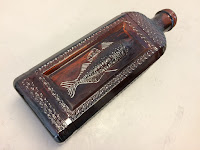
 The bottles are fun too.  The dark brown one is for cod liver oil. The middle one reads: Anderson & Co., Home Brewed Ale, Albany, NY and dates from about 1870.  The clear one on the right reads: A.F. Dietz, Altamont, Albany Co., NY and has a picture of a cow on the back.  It dates to about 1888.
Also in the photo is a piece of blue and white pottery and the bowl of a clay pipe. The pipe is probably from the mid 1800s.


The Maiers also shared a story about the name Glenmont that I had never heard before. They told me that the beginning part came from The Glen, a large estate up on River Road just north of Glenmont Road, and the second part of the name is from The Mont or The Mount, a large estate just up the hill on Glenmont Road on the north side. Put the two estate names together and you have Glenmont. Hmmmmm, could I verify this story?  Well, no.  But the way did lead down some interesting paths.

First up The Glen. Based on old maps and the story told by the Maiers, I think this is a reference to the Hurlbut farm (sometimes spelled Hurlburt), pictured below in a photo I stole from Google.  The book Albany Chronicles describes it as "the country-seat at Glenmont, upon the eminence west of "The Abbey."


In the late 1890s there are a few snippets in the Glenmont section of the Altamont Enterprise referring to Mr. G. D. W. Hurlbut, but I was unable to find any references to a property called The Glen.Here's one of my favorites from March 1899.  Note it refers to another estate by name, but not Hurlbuts.


Mr. G. D. W Hurlbut is Gansevoort DeWandlaer Hurlbut (1857-1901) son of Elisha Hurlbut (noted NY Supreme Court justice) and Catherine C. VanVechten Hurlbut.

The other property in the story is The Mont or The Mount.  I believe this is the Patterson farm located up the hill from Anders Road off of a long driveway on the right. Conveniently, this property at 111 Glenmont Road is for sale if you would like to spy it out. Top picture is from Zillow.  The bottom one shows the house back in the day and is courtesy of the Bethlehem Historical Association.


BHA records indicate that this is the Patterson house, Glenmont Hill which matches up with the old maps of the area. The town's OARS system says the house was built in 1901, which lines up with the tenancy of John J. Patterson.  A search of the Altamont Enterprise did not turn up any info regarding a property called The Mount.  I did turn up the tragic story of John Patterson (John J.'s father) and his nephew James Patterson.  Both were killed in September 1898 in an accidental explosion at their stone quarry.

So, I very much like the story of The Glen and The Mont, but so far have not found any primary sources to back it up.  For now, I'll call it plausible but not proven.

And a final note...wonderfully, the 1880 US census has the Frazers, Hurlbuts and Pattersons all on the same page.

Dwelling house 285 is the Fraziers (John and Ann and their daughters Jane, Kate, Mary, Sarah & Elizabeth.)
Dwelling house 286 is the Pattersons (head of household John and his son John J. daughter Louisa Rockefeller and her husband BR, nephew James Patterson, plus 4 other single adult men.)
Dwelling house 293 is the Hurlbuts ( E.P. and wife Catherine, sons Gansevoort and Ernest, plus George Pattendon farm laborer, Catherine Cahill and Elizabeth Callahan domestic servants and Elizabeth Callahn, cook.)